
 based on 15 reviews
Everest Base Camp is one of the most popular base camps in the world, with thousands of people trekking to this destination. If you are planning on going through this journey to reach the Everest Base Camp, then you definitely need an Everest Base Camp Trek Map to help you along the way. The map includes the distance between checkpoints, important spots, rest places, and route options.
Here, we will be covering the classic route, different versions of it with altitude details, as well as how to use both the digital and paper forms of maps.
Explore the Everest Base Camp Trek Map and prepare for every stage of the trek with Abound Holidays.
Overview of the Everest Base Camp Trek Route
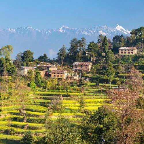
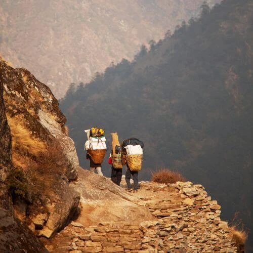
The starting point for your Eeverest Base Camp trek is the famous place Lukla. You will be travelling through Sherpa villages and witnessing ancient monasteries and beautiful viewpoints along the way. On your way to the EBC, you will go through places like Namche Bazaar, Tengboche, Dingboche, and other checkpoints. Here, you also have an option to choose an alternative starting point like Jiri for a longer approach and better acclimatization time.

The trail variations also include the Gokyo Valley and the Everest Three Passes trek if you want a side trip. These treks offer higher elevation points, with fewer crowds and stunning panoramic views. That's why using the Everest Base Camp Trek Map is essential, as it helps you visualize the villages, routes, rest points, and many other factors in your trek.
Highlights of the classic route:
- Walk along rivers and suspension bridges
- Visit Tengboche Monastery
- Experience the Sherpa village culture
- Scenic views of Everest and surrounding peaks
Daily Itinerary with Distance, Duration, and Elevation
Your first day on the trek begins in Lukla (2,840 m), which is already at high altitude, so even the first day requires careful pacing. Your next destination will be Phakding, which you will reach in around 3 hours of trekking. And you are officially on the trekking route of the Everest Base Camp.
Daily Stages Table:
Stage | Distance (km) | Avg Walking Time | Altitude (m) |
Lukla to Phakding | 8 | 3 hrs | 2,840 to 2,650 |
Phakding to Namche Bazaar | 10 | 5-6 hrs | 2,650 to 3,440 |
Namche Bazaar | 0 | Rest / short hikes | 3,440 |
Namche Bazaar to Tengboche | 9 | 5 hrs | 3,440 to 3,860 |
Tengboche to Dingboche | 11 | 5-6 hrs | 3,860 to 4,410 |
Dingboche | 0 | Rest / short hikes | 4,410 |
Dingboche to Lobuche | 10 | 5 hrs | 4,410 to 5,050 |
Lobuche to Gorakshep | 8 | 3-4 hrs | 5,050 to 5,170 |
Gorakshep to Everest Base Camp to Gorakshep | 14 | 7-8 hrs | 5,170 to 5,364 to 5,170 |
Gorakshep to Kala Patthar to Pheriche | 12 | 6-7 hrs | 5,170 to 5,545 to 4,288 |
Check your pace and altitude gain for each stage of the Everest Base Camp Trek to ensure a safe and enjoyable trek.
Route Variations and Total Distances
Not all treks to EBC follow the same path. The Everest Base Camp Trek Map helps compare options so you can pick the one that fits your goals.
Route | Distance (km) | Trekking Days | Difficulty | Highlights |
Classic Lukla to EBC | 130 | 12 - 14 | Moderate | Villages, monasteries, and Everest views |
Gokyo Valley Route | 160 | 14 - 16 | Hard | Gokyo Lakes, higher elevation, less crowded |
Three Passes Trek | 230 | 18 - 20 | Very Hard | Cho La, Kongma La, Renjo La passes, panoramic views |
Key Differences:
- Classic: Easier, most villages and tea houses, popular
- Gokyo: Higher lakes, more remote, extra acclimatization
- Three Passes: Challenging high passes, longer duration, extreme views
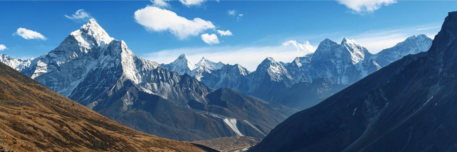
Altitude Profile and Elevation Insights
High altitude affects energy and breathing. The Everest Base Camp elevation map shows elevation gains and losses across the trek, highlighting the steepest sections.
Key High Points:
- Lobuche (5,050 m): Rocky climbs, short breaks needed
- Gorakshep (5,170 m): Base for EBC, cold and windy
- Kala Patthar (5,545 m): Sunrise viewpoint, strenuous climb
Tips for managing altitude:
- Walk slowly on steep sections
- Hydrate frequently
- Use your Everest Base Camp Trek Map to plan pacing
Difficulty Levels by Trekking Segment
Difficulty varies by stage due to slope, altitude, and trail conditions. Using the Everest Base Camp Trek Map, you can identify which sections require extra effort.
Difficulty Guide:
- Easy: Lukla → Phakding, lower valleys
- Moderate: Phakding → Namche Bazaar, Tengboche → Dingboche
- Hard: Dingboche → Lobuche → Gorakshep → EBC, Kala Patthar hike
Preparation Tips:
- Train with uphill walks or stair climbing
- Carry layered clothing for cold conditions
- Pace yourself on high-altitude sections
How to Use the Everest Base Camp Map
A map isn’t just a picture you look at. It’s something you really need for finding your way, staying safe, and planning your whole trip on the Everest Base Camp trek. An Everest region map shows the trails, villages, teahouses, rivers, glaciers, and height levels. When you know how to read the map, you can plan how far you’ll walk each day, see how much you’ve done, and get ready for the hard parts before you even start the trek.
Key Points for Using the Map:
- When you’re trekking in the Everest region, trails usually have stone piles or painted signs. Your map is your buddy here because it helps you make sure you’re going the right way and not getting lost.
- It’s a good idea to look at the map to see how high each village, pass, and peak is. This way, you can plan how fast to walk, when to take breaks, and which days you might need to slow down a bit to get used to the altitude.
- Rivers, bridges, monasteries, and glaciers on the map act like little checkpoints. They make it much easier to figure out where you are as you go along the trek.
- You should also use the map’s distance markers along with how fast you walk and the ups and downs of the trail to estimate how long each day’s walk will take.
- Even if you rely on apps like Everest Base Camp Google Maps, it’s smart to carry a paper map as a backup in case your battery dies or the signal is weak.
- Finally, remember that maps aren’t always completely up-to-date. Trails can change, and new teahouses can appear, so it’s a good idea to check with local guides or villagers to make sure your map information is accurate.
Digital Maps vs Paper Maps
Using maps the right way is really important for a safe and smooth Everest Base Camp trek. Digital maps are convenient, but paper maps are still essential as a backup. Knowing how to use both helps you navigate the trails with confidence, no matter what the conditions are.
Digital Maps:
- Interactive & GPS Enabled: Apps like Everest Base Camp Google Maps and Organic Maps allow you to track your location in real time.
- Offline Mode: Many trekking apps work without mobile data, which is crucial in the Everest region, where the signal is limited.
- Route Planning: You can measure distances, check elevation profiles, and set waypoints for campsites or tea houses.
Paper Maps:
- Reliable Backup: Batteries die, devices fail, or GPS can misbehave—paper maps ensure you never lose track of your route.
- Clear Overview: A printed Everest Base Camp Trek Map PDF or paper map provides a bird’s-eye view of the entire trail, helping with pacing and planning multiple days at once.
- Landmarks & Terrain: Rivers, glaciers, passes, and village locations are easy to spot, helping you orient yourself even in fog or low visibility.
- Accessible Anywhere: No need for charging or internet; you can quickly reference it while walking or resting.
Combine digital and paper maps to navigate the Everest region confidently.
Best Time to Use the Map for Planning
As we know the best time for Everest Base Camp Trek is during spring and autumn seasons. Then, when is the best time to use the Everest Base Camp trek map for planning? A map is more than just a navigation tool, as it is essential for planning your trek safely and efficiently. The Everest Base Camp Trek Map helps you anticipate daily distances, elevation changes, and potential challenges before you even set foot on the trail.
Peak Seasons (Spring and Autumn):
March-May and September-November offer stable weather, clear skies, and good mountain views. The Everest Base Camp Trek Map helps plan daily distances, acclimatization days, and navigation through busy villages like Namche Bazaar.
Off-Seasons (Winter and Monsoon):
December-February and June-August bring snow, ice, or heavy rains. The map helps plan shorter stages, locate safe tea houses, and adjust routes according to trail conditions.
Book Your EBC Trek with Abound Holidays
The Everest Base Camp trek is an adventure you’ll never forget, but it needs some careful planning to handle the long distances, changes in elevation, getting used to the altitude, and finding your way on the trails. Using the Everest Base Camp Trek Map helps you see the routes, daily stages, and height changes, so you can get ready for each part of the trek safely and easily.
When you book with Abound Holidays, you get expert guidance every step of the way. Our experienced guides know every route, village, and trail marker in the Everest region. We plan itineraries that fit your pace, set up rest days, and handle all the logistics—from permits to teahouse bookings. With our help, you can focus on enjoying the trek, taking in the scenery, and walking with confidence.
Plan your Everest Base Camp trek with Abound Holidays and experience the trail safely with expert guides. Contact us today!
Check Our Other Everest Base Camp Trek Packages
Everest Chola Pass Trek | Everest Three Passes Trek | Everest Base Camp Short Trek | Lhasa Tour with EBC | Tibet EBC Trek | Everest Helicopter Tour | Everest Base Camp Trek
Learn More About Everest Base Camp
Safety on EBC Trek | Acclimatization on EBC Trek | How Long Is EBC Trek | Everest Base Camp vs Annapurna Circuit | EBC Trek vs EBC Mountain Flight | EBC Packing List | Permits Necessary for EBC Trek | Reasons To Do EBC Trek | EBC Trek Difficulty | Best Time for EBC Trek
FAQs
Do I need a map for the Everest Base Camp trek?
Yes, a map is highly recommended. The Everest Base Camp Trek Map helps you understand daily distances, elevation changes, and key villages, making navigation safer and planning more accurate.
How accurate are digital EBC maps?
Digital maps like Everest Base Camp Google Maps or offline GPS apps are generally accurate, but trail conditions can change. Always cross-check with local guides or a printed map for safe navigation.
Can beginners follow the EBC route without a guide?
While some experienced trekkers attempt it independently, beginners should hire a guide. Maps help, but guides provide knowledge about trail conditions, altitude management, and safety.
Which map variant is best for my trek: classic, Gokyo, or Three Passes?
It depends on your time, fitness, and goals. The classic EBC route is the shortest and most popular. Gokyo adds lakes and extra trekking days, and the Three Passes route is more challenging with high-altitude passes. Use the Everest Base Camp Trek Map PDF to compare distances and elevation before deciding.
H3: Where can I buy a printed EBC map, and how much does it cost?
Printed maps are available in Kathmandu and Lukla, often for $5 - $10. They provide a reliable backup to digital maps and are useful in low-signal areas.
How does the map help plan acclimatization days?
The map shows elevation changes between villages and trail stages. By checking daily altitude gain, you can schedule rest or short hikes in places like Namche Bazaar or Dingboche to adjust safely to high altitudes.
How difficult are each of the trekking segments shown on the map?
Segments vary from easy to challenging based on distance, trail conditions, and altitude gain. Lower stages like Lukla to Phakding are easier, while higher sections like Lobuche to Gorakshep or Kala Patthar involve steep climbs and thin air.
Are landmarks, tea houses, and rest points clearly indicated on most maps?
Yes, detailed maps show villages, tea houses, monasteries, rivers, and key landmarks, helping trekkers navigate and plan stops along the route.